Açıklama
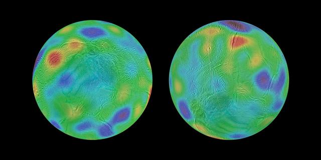
Working with image data from NASA's Cassini mission, researchers have found evidence that Saturn's moon Enceladus may have tipped over, reorienting itself so that terrain closer to its original equator was relocated to the poles. This phenomenon is known as true polar wander. Researchers discovered a chain of basins across the surface of Enceladus along with a pair of depressions that line up with an equator and poles, respectively, if the moon's axis of rotation was reoriented by about 55 degrees of latitude. These maps look toward the icy moon's southern hemisphere, with colors representing highs and lows. Purple represents the lowest elevations, while red represents the highest. The map a — NASA JPL · 2017. ABD devlet eseri: kamu mali, ticari islerde de serbestce kullanilabilir.
Kaynak ve lisans
Bu eser kamu malı ya da açık lisanslı. Lisans koşulları kaynağın kendi sayfasında yazılı.
Nasıl açılır?
Ürünü indirmek ya da uygulama içinde okumak için Shopy 101 uygulamasını kullan. Kitaplığına eklediğin her şey tüm cihazlarında aynı kalır.