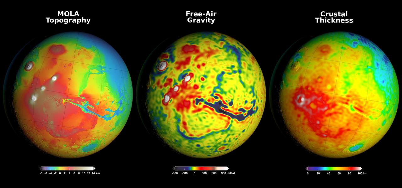
Using Gravity and Topography to Map Mars' Crustal Thickness
Ücretsiz
Açıklama
Newly detailed mapping of local variations in Mars' gravitational pull on orbiters (center), combined with topographical mapping of the planet's mountains and valleys (left) yields the best-yet mapping of Mars' crustal thickness (right). These three views of global mapping are centered at 90 degrees west longitude, showing portions of the planet that include tall volcanoes on the left and the deep Valles Marineris canyon system just right of center. Additional views of these global maps are available at http://svs.gsfc.nasa.gov/goto?4436. The new map of Mars' gravity (center) results from analysis of the planet's gravitational effects on orbiters passing over each location on the globe. The — NASA JPL · 2016. ABD devlet eseri: kamu mali, ticari islerde de serbestce kullanilabilir.
Kaynak ve lisans
Bu eser kamu malı ya da açık lisanslı. Lisans koşulları kaynağın kendi sayfasında yazılı.
Nasıl açılır?
Ürünü indirmek ya da uygulama içinde okumak için Shopy 101 uygulamasını kullan. Kitaplığına eklediğin her şey tüm cihazlarında aynı kalır.