Açıklama
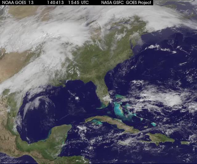
NOAA's GOES-13 satellite saw a large pesky front, one that stretched from Maine to Louisiana on April 13 at 16:15 UTC/12:15 p.m. EDT to April 16 at 12:15 p.m. EDT. This weather pattern did not bode well for people who wanted to see the lunar eclipse on April 15. The GOES-13 satellite images and animations are created at NASA/NOAA's GOES Project at the NASA Goddard Space Flight Center, Greenbelt, Md. <b><a href="http://goes.gsfc.nasa.gov/" rel="nofollow">Credit: NOAA/NASA GOES Project</a></b> <b><a href="http://www.nasa.gov/audience/formedia/features/MP_Photo_Guidelines.html" rel="nofollow">NASA image use policy.</a></b> <b><a href="http://www.nasa.gov/centers/goddard/home/index.html" rel="no — NASA GSFC · 2017. ABD devlet eseri: kamu mali, ticari islerde de serbestce kullanilabilir.
Kaynak ve lisans
Bu eser kamu malı ya da açık lisanslı. Lisans koşulları kaynağın kendi sayfasında yazılı.
Nasıl açılır?
Ürünü indirmek ya da uygulama içinde okumak için Shopy 101 uygulamasını kullan. Kitaplığına eklediğin her şey tüm cihazlarında aynı kalır.