About
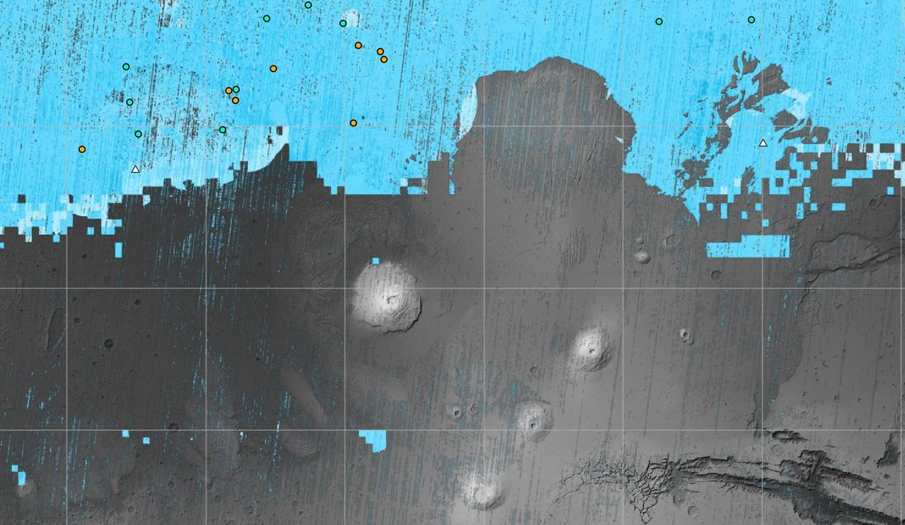
The blue areas on this map of Mars show regions where NASA missions have detected subsurface water ice. Scientists can use the map – part of the Subsurface Water Ice Mapping project, or SWIM – to decide where the first astronauts to set foot on the Red Planet should land. Triangles on the map are past and present Mars missions; circles are ice-exposing impact craters. Mars has both water ice and carbon dioxide ice (dry ice); water ice would be a critical resource for the first astronauts to step foot on Mars, who can use it for drinking, rocket fuel, and other purposes. The more water ice these astronauts land next to, the less they need to bring with them. Because the Martian atmosphere is — NASA JPL · 2023. ABD devlet eseri: kamu mali, ticari islerde de serbestce kullanilabilir.
Source and licence
This work is public domain or openly licensed. The licence terms are published by the source.
How do I open it?
Use the Shopy 101 app to download it or read it in place. Anything you add to your library stays the same on every device.