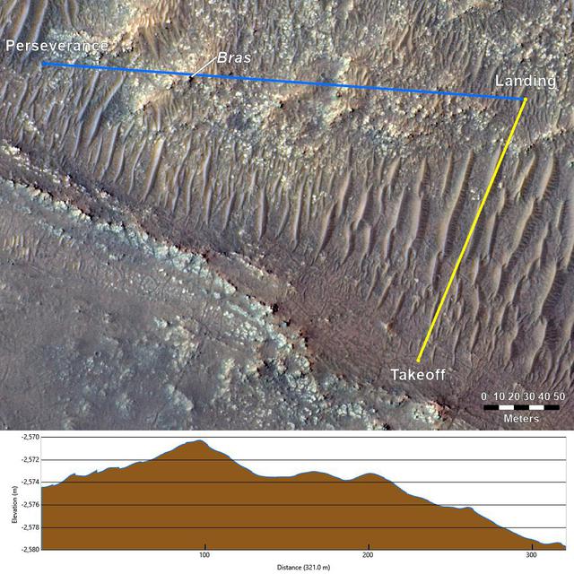
Topography Between Mars Helicopter and Rover for Flight 17
Free
About
This annotated image from NASA's Mars Reconnaissance Orbiter (MRO), and the topographic map below it, provide a look at the altitude of surface features standing between the agency's Perseverance Mars rover and Ingenuity helicopter at the conclusion of the rotorcraft's 17th flight at Mars on Dec. 5, 2021. In the image of the surface – taken by MRO's High Resolution Science Experiment (HiRISE) camera – Ingenuity's flight path is depicted in yellow. Perseverance's location is indicated in the upper left, with the blue line delineating its line of sight to the helicopter's landing spot. The location of the tallest point on Mars' surface between rover and helicopter during its final descent is t — NASA JPL · 2021. ABD devlet eseri: kamu mali, ticari islerde de serbestce kullanilabilir.
Source and licence
This work is public domain or openly licensed. The licence terms are published by the source.
How do I open it?
Use the Shopy 101 app to download it or read it in place. Anything you add to your library stays the same on every device.