About
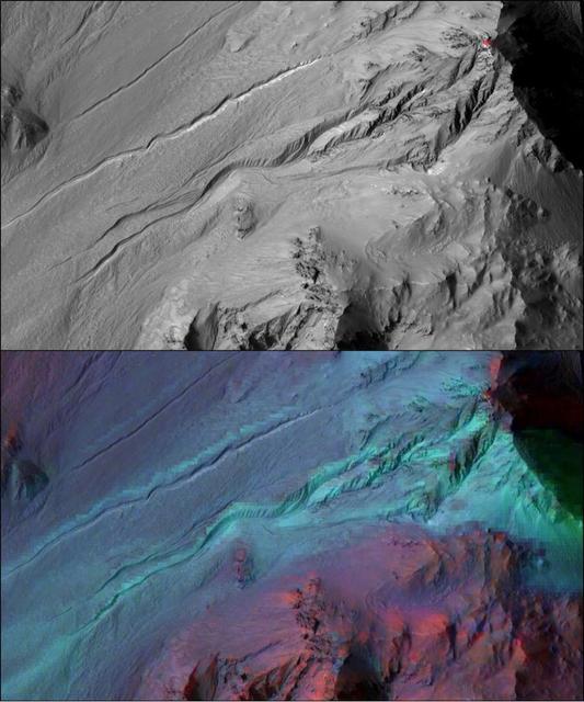
The highly incised Martian gullies seen in the top image resemble gullies on Earth that are carved by liquid water. However, when the gullies are observed with the addition of mineralogical information (bottom), no evidence for alteration by water appears. The pictured area spans about 2 miles (3 kilometers) on the eastern rim of Hale Crater. The High Resolution Imaging Science Experiment (HiRISE) camera on NASA's Mars Reconnaissance Orbiter took the visible-light image. Color-coded compositional information added in the lower version comes from the same orbiter's Compact Reconnaissance Imaging Spectrometer for Mars (CRISM). Color coding in light blue corresponds to surface composition of un — NASA JPL · 2016. ABD devlet eseri: kamu mali, ticari islerde de serbestce kullanilabilir.
Source and licence
This work is public domain or openly licensed. The licence terms are published by the source.
How do I open it?
Use the Shopy 101 app to download it or read it in place. Anything you add to your library stays the same on every device.